CHINA
Pilgrims take selfies last September at Drolma La, the highest point on their 32-mile kora—a circular, meditative walk around Mount Kangrinboqe in Tibet. The mountain is sacred to four religions, and four of South Asia’s rivers rise from near its cardinal points. The source of the Indus River is a four-day walk north of the mountain.
Photography for this article was supported in part by the South Asian Journalists Association.
From near Mount Kangrinboqe in Tibet rise four major rivers, which stretch east and west across the Himalaya and down to the sea like the limbs of a venerable water goddess. Where these rivers flow, they define civilizations and nations: Tibet, Pakistan, northern India, Nepal, Bangladesh. How their water is spent has long depended on the people living downstream. How the rivers are replenished depends on two things: monsoon rains and glacial ice melt. Both phenomena, for millennia the preserve of the gods, are now in the hands of humans too. (See why these 10 rivers are vital to Asia’s survival.)
Rivers emerging from the eastern Himalaya, like the Brahmaputra, are mostly fed by the summer monsoon; their flow may well increase as a warming climate puts more moisture in the atmosphere. But most water in the Indus, which flows west from Mount Kangrinboqe, comes from the snows and glaciers of the Himalaya, the Karakoram, and the Hindu Kush. Glaciers especially are “water towers”: They store winter snowfall as ice, high in the mountains, and they surrender it as meltwater in spring and summer. In this way, they provide a steady flow that nourishes humans and ecosystems. Downstream, in the plains of Pakistan and northern India, the world’s most extensive system of irrigated agriculture depends on the Indus. The glaciers that feed it are a lifeline for some 270 million people. (The Indus River is a lifeline for millions. This map shows the threats it faces.)
INDIA
Schoolchildren in the village of Gya, Ladakh, cross a glacial stream that feeds the Indus. The river flows through Ladakh, an arid, high-altitude region in northernmost India, on its
Most of those glaciers are now shrinking. At first, that will increase the flow in the Indus. But if temperatures rise as predicted, and the glaciers continue to melt back, the Indus will reach “peak water” by 2050. After that, the flow will decline.
Humans already use 95 percent of the Indus, and the population of the basin is growing fast. Writing recently in the journal Nature, an international group of scientists (supported by the National Geographic Society) analyzed glacial water towers worldwide. The Indus is the most critical, they said: Given the region’s “high baseline water stress and limited government effectiveness,” it is “unlikely that the Indus … can sustain this pressure.” Pakistan will suffer most.
From 2003 to 2006, I traveled the 2,000-mile river, from the Arabian Sea to its source in Tibet, researching my book Empires of the Indus. Already it was clear that it was under strain. The Indus had changed out of all recognition from the mighty river described by British colonial officials. It had been diminished by the demands of irrigation, industry, and daily life. Because of dams and barrages, it no longer reached the sea, and its mangrove-forested delta was dying. Its lakes were polluted with effluents and sewage.
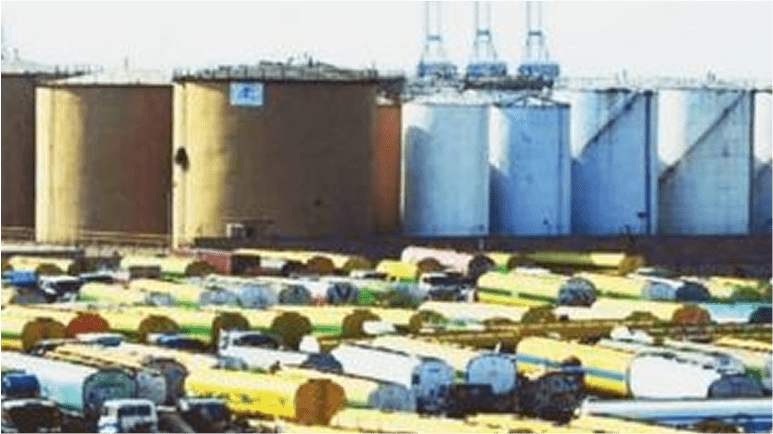
PAKISTANThe ice-fed torrent of the mountains spreads to its full breadth in the plains of Sindh in southern Pakistan. The barrage at Sukkur, visible in the distance, was built during colonial times. It funnels Indus water into a network of canals to irrigate crops such as cotton, wheat, and rice in the desert. Along the Indus, the British created what is still the world’s largest irrigation system.
I was struck by how the Indus, celebrated from ancient times in sacred Sanskrit hymns, was treated as a resource but no longer as an object of reverence. Everyone I met, from peasants to politicians, thought the river was being mismanaged. They spoke of corrupt or inefficient engineering projects, inequitable water sharing, and ecosystems destroyed in the name of profit.
At the time, not many people were talking about the effect of global warming on the Indus. It wasn’t until 2010 that the scale of the problem became clear—through dramatic floods rather than a shortage. The future of total rainfall in the Himalayan region is uncertain, but there has been a clear increase in extreme rains. In August 2010, when the Indus was already full of summer meltwater, it was hit by a freak monsoon. The torrential rain—in some places, a year’s worth in a few hours—caused the river to breach its banks throughout its southern course. More than 1,600 people died; damages reached $10 billion.
“Flooding on that scale was unheard of,” said Usman Qazi, an Islamabad-based disaster-relief expert with the United Nations Development Programme. “But it will become more common,” he added. “Climate change–related floods are one of the biggest hazards in this country.”
CHINA
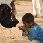
Nomad children fetch water from the Indus near its source in Tibet. China controls the headwaters of the river. In 2006 it constructed a dam without informing India and Pakistan, which heavily depend on the river.
This is the starkest difference since I wrote my book: The specter of climate change now haunts all discussions of the future of the Indus. The challenge is made infinitely more complex because the Indus and five of its tributaries are shared by India and Pakistan, neighbors and enemies since 1947, while China controls the headwaters. When I reached Tibet in 2006, on my journey to the source, I was shocked to find that there was no water in the Indus: China had recently dammed the river’s upper reaches.
India, Pakistan, and China have huge populations and abundant reasons to protect their resources. All three have nuclear weapons. We think of climate change as happening in increments, almost imperceptibly. But along the Indus, it could trigger a conflict that changes the world overnight.
There was a time when humans were so grateful for rivers, they made them into divinities.
In the Rig Veda, India’s most ancient Sanskrit text, the Indus is the only river worshipped as both god and goddess, father and mother—probably because it was here, in the Indus Valley, that Hinduism took its first form, experts believe.
TIBET
A pilgrim from Atlanta, Georgia, is doused with the sacred waters of Lake Manasarovar in Tibet, near Mount Kangrinboqe and the source of the Indus. Thousands of pilgrims trek around the mountain each year, but the Chinese government has banned bathing in the lake.
North of Kangrinboqe, the great river bubbles modestly out of the ground, as if that four-armed goddess were breathing out. It runs west through the mountains, along the top of India, and across the disputed border into Pakistan. Where the Himalaya meets the Karakoram and the Hindu Kush, in a knot of stone and ice, the river makes a sharp left and is funneled south, a thousand miles through the plains of Punjab and Sindh to the Arabian Sea.
About 40 miles north of that turning point, in the valley of the Hunza, an Indus tributary, I walked onto Ghulkin, a glacier with orchards and villages on either side. It was black with dirt and rubble from the mountains. I stepped over creaking crevasses; with my fingers I touched the ice body itself. From the summit, the view was exhilarating. The torrential brown river cut its way through the valley. Leading down to it were exquisite strips of psychedelic green, fields and orchards in which every leaf is watered by irrigation channels connected directly to the glacier.
In northern Pakistan, Islamic monotheism manages to coexist with a shamanistic appreciation of glaciers’ power. I was told many times that Ghulkin was a male glacier, “advancing down the valley in search of a female mate”—that is, a retreating glacier—in a mystical courtship dance. Glaciers advance, local people said, because they’re accumulating mass. That’s true—but as I learned later from glacial geologist Bethan Davies at Royal Holloway in London, a glacier also can slide downhill like a child’s sled because it has started to melt and come unstuck.